Iconic Sites Along the Neponset River Greenway

Resources and quoted information on the history of the Neponset River compiled by Art & Soul Clinic.

Take the self-led tour (suggested route) along the Greenway from the Mattapan T Station to Tenean Beach. Scan the QR codes posted at each site along the route to learn more.

The Neponset River Greenway connects the neighborhoods of Readville, Hyde Park, Milton, Mattapan, and Dorchester. The Greenway was constructed in the early 2000’s with the newest sections created as recently as 2018 (Harvest River Bridge in Mattapan) and 2025 (along Morrissey Blvd in Dorchester). It is an active walk/bike trail for residents providing scenic views of the Boston Harbor and plenty of opportunities for immersion with nature.
Additional Resources:

  1. Get to Know the Neponset River by Massachusetts Rivers Alliance

  2. Mapping the Neponset: A Digital Tour of the River’s History by the Boston College Neponset River Lab

  3. Learn more about some of the arts along the river and support the Neponset Greenway Mural Project.

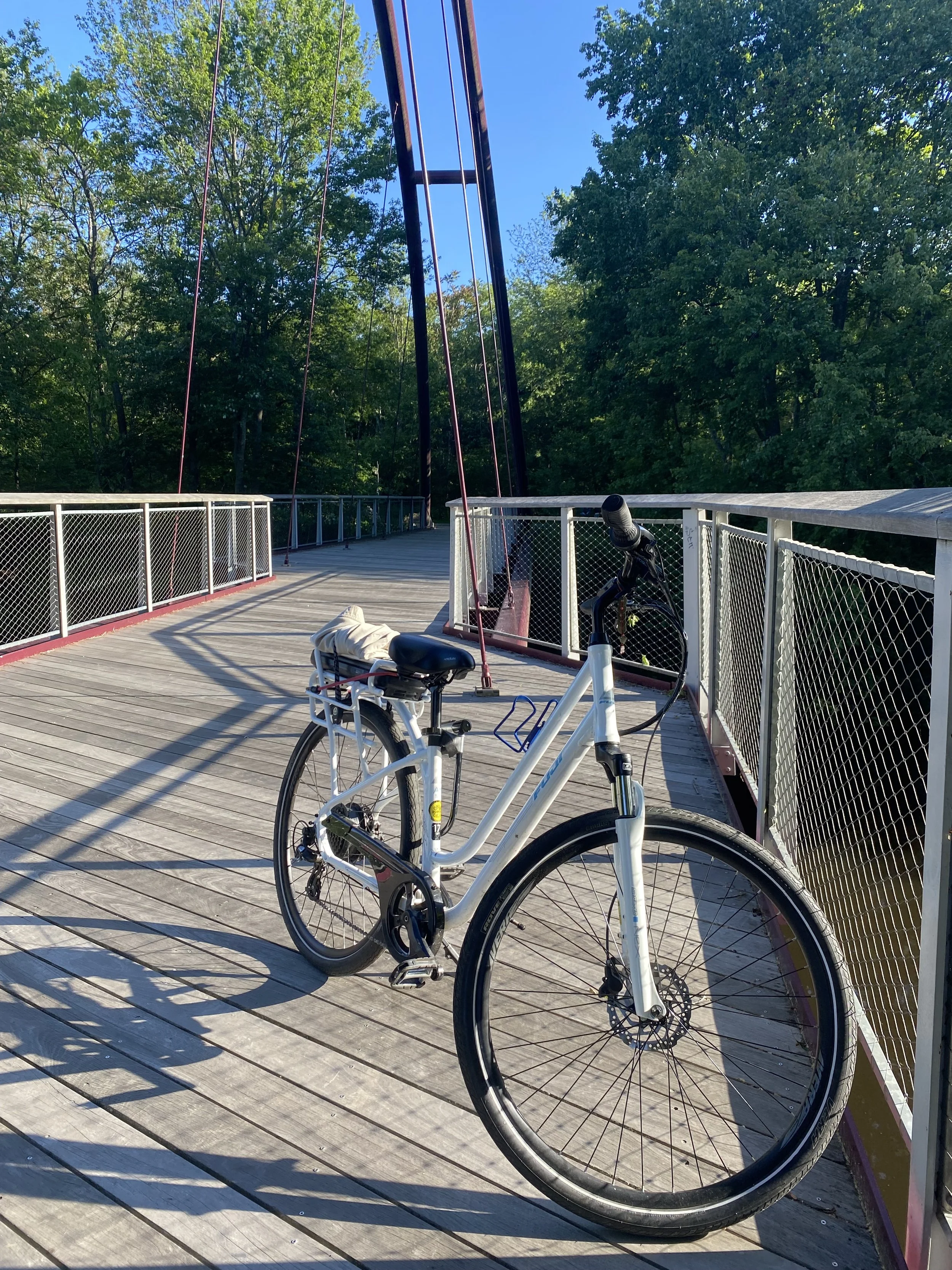
The Harvest River Bridge

“Overall, the Neponset River travels more than 29 miles, starting at Gillette Stadium and ending near the gas tanks along the Southeast Expressway…The recorded history of the Neponset starts around 1619, when Native Americans would use the river as a route to trade furs, largely muskrat and beaver.” (Source)

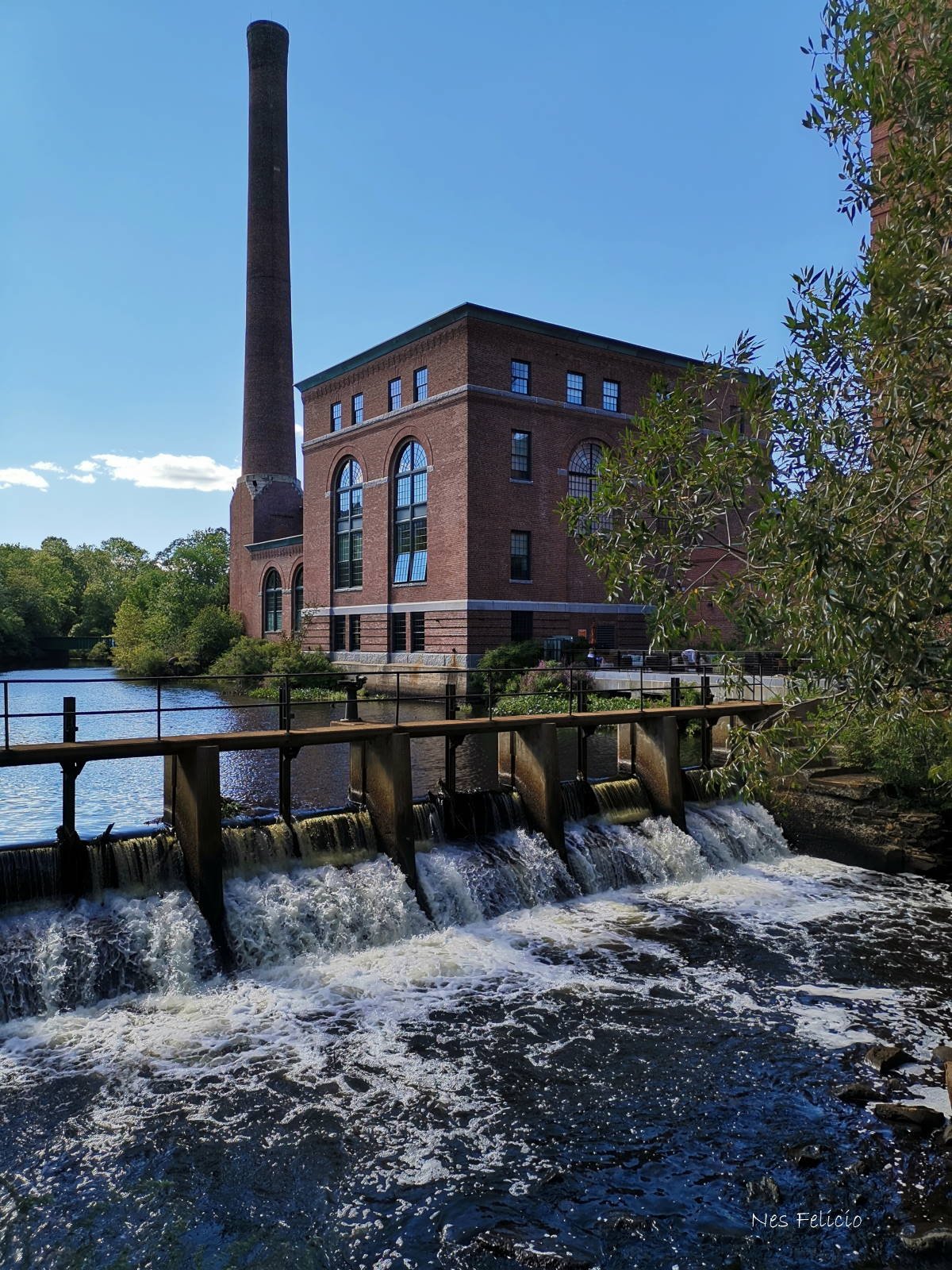
“Early local industries relied on the river for a supply of water, a space for dumping waste, and a source of power for manufacturing infrastructure like mills and dams. Many of these mills—supporting the production of flour, gun powder, paper, lumber, and chocolate—were concentrated in today's Dorchester-Milton Lower Mills Industrial District and Upper Falls area.” (Source)

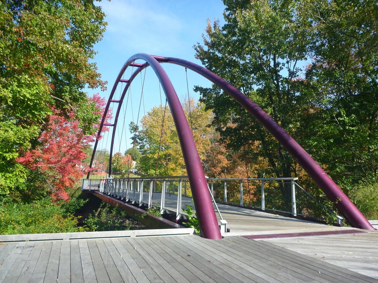
“The Greenway section between Mattapan Square and Central Ave is used by thousands of people on a weekly basis….Completed in 2017, it connects Mattapan and Milton via the beautiful Harvest River Bridge. This section has made the local community increasingly aware of the Neponset River, and has connected people from diverse backgrounds with a common interest in getting outside in their own neighborhoods.” (Source)

Local concerns regarding the installation of the Harvest River Bridge contributed to tensions within the community: “On the Mattapan side, residents worried of the unjust cost that construction might place on their community. On the Milton side, residents voiced fear of violence and poverty spreading across the border, revealing the extent to which historic spatial fears continue to dictate divisions. A bridge would not just serve the Greenway as a whole, it was an opportunity to address this divide.” (Source)

“Onsite, there is an engraved marker featuring a river fish with the following text underneath:

The Massachusett Tribe of the Algonquian Nation called the river ‘Neponset’ (Harvest River). In the spring, herring and smelt hurdle the rapids to spawn in the fresh water upstream.” (Source)

The Walter Baker Chocolate Factory

This site reflects the robust industrial history of the Neponset River and reminds us of the ways this history has impacted the community and the local environment over time. In 1633 Israel Stoughton, a European settler with economic privilege, built a water-powered mill to grind corn into cornmeal along the Neponset River. The presence of the mill increased the community’s ability to produce food and trade, leading to an increase in demand and population. “Geology and topography made waterpower possible: New England has many rivers with steep, rocky banks and swift flow, where dams and mills could be built by hand.” (Source)

“A powder mill built in 1675 ground the gunpowder European colonists used to battle an alliance of indigenous peoples across southern New England in the pivotal conflict known today as King Philip’s War….The war was the culmination of decades of colonial encroachment on Native-held resources, especially farmland, forests, quarries, and fishing areas such as the Neponset River.” (Source)

The local ecosystem has been greatly impacted by the presence of the mills at this site: “Alewives are anadromous fish which means that they live most of their lives in the ocean, but return to freshwater, swimming upstream in rivers like the Neponset, to lay their eggs. Currently the alewife population in Massachusetts is depleted. The population decline is due in part to overfishing, but large industrial dams also block the fishes' path up the river, preventing them from spawning in the locations where they were once so plentiful, places like that spot in the river that once powered Israel Stoughton’s mill.” (Source)

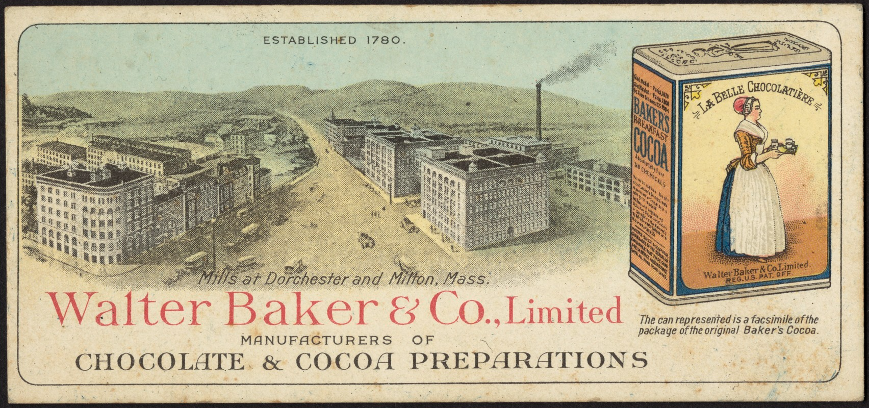
Later on in 1764, Irish immigrant John Hannon proposed harnessing the water power for a new chocolate-making technique he learned in London, and general store owner James Baker jumped on the idea as a prospective business opportunity. On March 8, 1765, Hannon began making chocolate in a saw mill financed by Baker and powered by the Neponset. The history of the mill is entangled with slavery: “The cocoa processed along the Neponset River in this early period was grown by enslaved laborers. American manufacturers up and down the East Coast bought cocoa beans from slave plantations in the Caribbean and Brazil.” (Source)

“The Baker name ran the Boston chocolate scene until 1965, when operations moved to Delaware.” The Walter Baker sign is still visible from the Lower Mills area on Dorchester Avenue. (Source) The former Walter Baker buildings are now used for a variety of residential and commercial purposes.

Cedar Grove Cemetery

The “Cemetery on Neponset River” came to life in the late 1860s in Dorchester, with the first burial taking place in 1870. The cemetery gets its name from the groves of cedar trees growing along the river. Today the cemetery sits on approximately 70 acres and has had more than 45,000 burials. Their current available inventory is “800 gravesites, several above-ground crypts, and a few niches for ashes.” (Source)

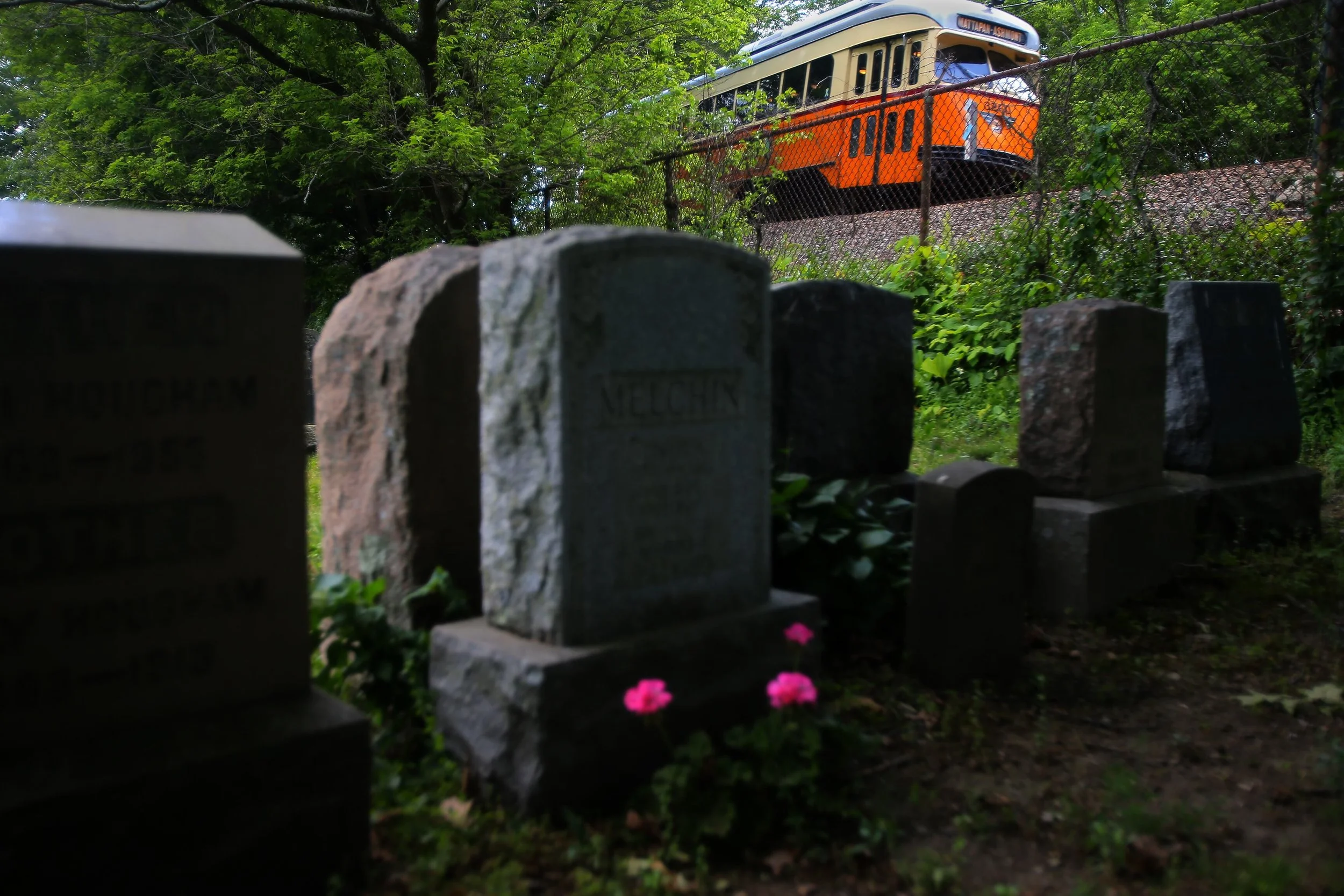
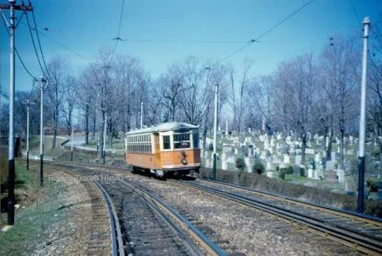
This site is widely known for being the only cemetery in the United States to feature a railway running right through it. The train service began in 1929 and today you can still see the bright orange trolley passing through from Ashmont to Mattapan. (Source)

Cedar Grove Cemetery is the site for the burials of women from the Home for Aged Colored Women (HACW). HACW “was founded in 1860 in Boston by a group of abolitionists, both black and white, to provide support to elderly African American women in need of housing and/or financial aid.” After coming across the unlabeled headstones of many women of color from the home, creative thinker and local resident Joyce Linehan led a research project in partnership with the cemetery and the Massachusetts Historical Society to identify the women buried at the sites from 1865 into the 20th century. This work continues today with Ekua Holmes comissioned to create a public memorial in honor of 133 of the women buried at Cedar Grove Cemetery. (Source)

Did you know that the section of the Neponset Greenway that borders the cemetery is covered with Phragmites australis, or common reeds, that are actually an invasive plant species? These plants are invasive because their roots release chemicals in the soil that prevent the growth of plants native to American salt marshes such as cattails and bulrushes. (Source)

Tenean Beach

Photo Source: David Lyon

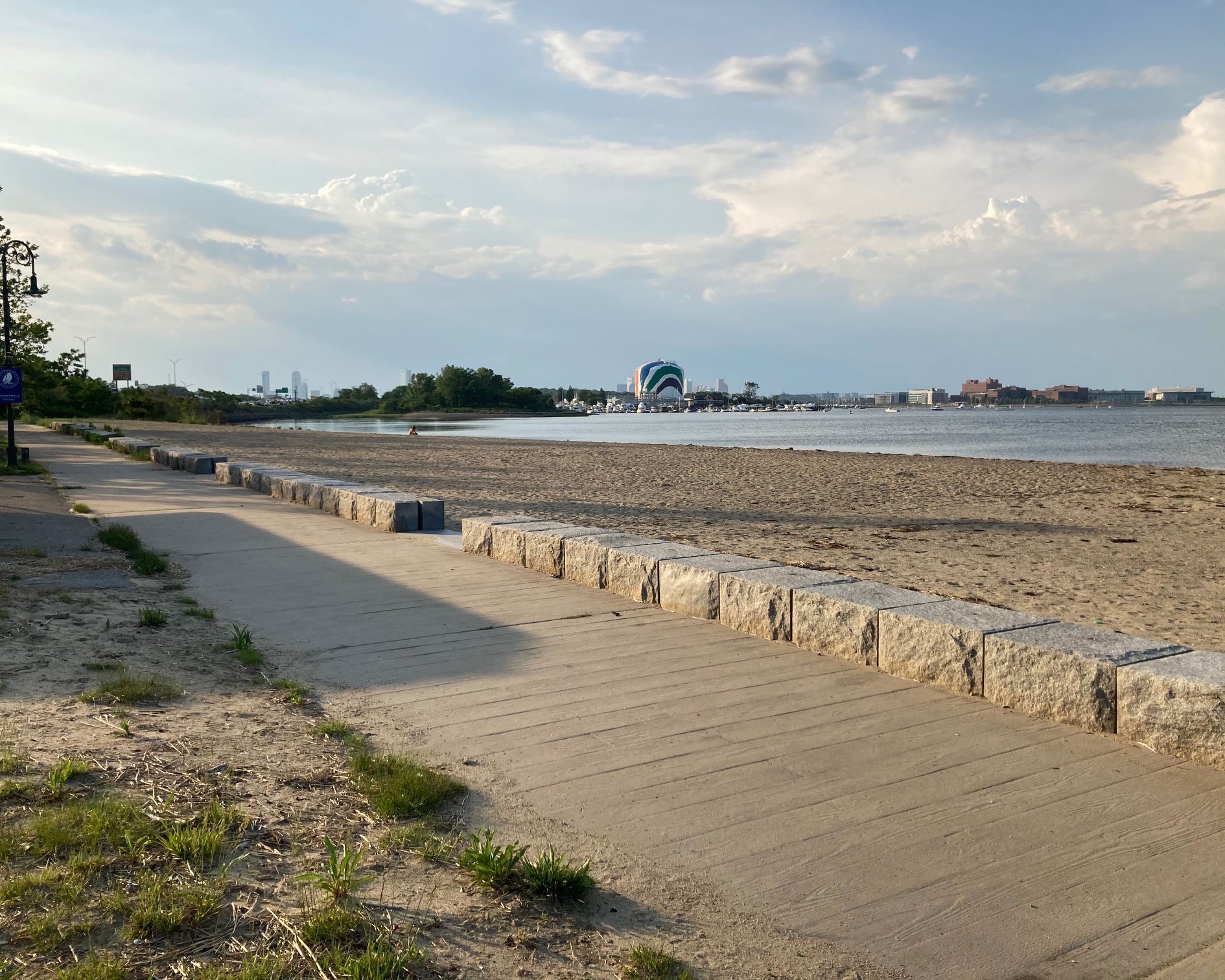
Tenean Beach, established by the city in the early 20th century, is located on the tip of Port Norfolk and sits at the mouth of the Neponset River. Tenean Beach has direct access for pedestrians and bikers from communities in Dorchester, Mattapan, Milton and Hyde Park. In the past, “Port Norfolk’s wharf along Walnut Street quickly became a center for shipping and industry. The neighborhood thrived as a hub for lumber, ice, and coal, with warehouses and stables lining the waterfront.” (Source)

A darker historical connection to Tenean Beach involves the notorious Boston mobster James "Whitey" Bulger and gang who were accused of killing 19 people in the 1970s and 1980s. An expert witness on the trial described finding some of the bodies of those killed buried along the beaches. One woman was identified by “DNA in her hair, which had been preserved by salt water that seeped into her unmarked beach grave.”

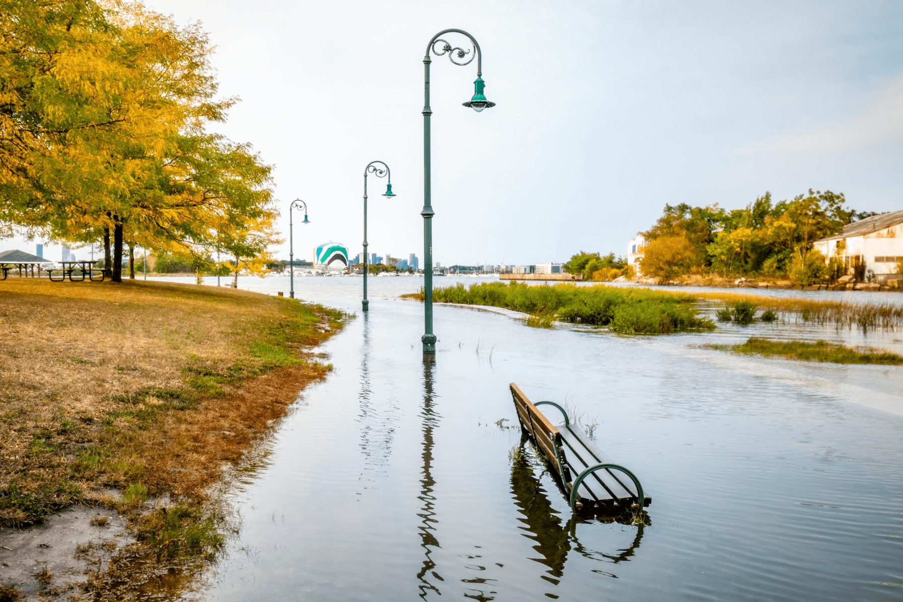
Tenean Beach is highly vulnerable to coastal flooding. During previous king tide events in Boston, the beach park and neighboring streets (such as Conley Street and Morrissey Blvd) were covered in water, cutting off access to the Point Norfolk neighborhood. “The Conley Street underpass, which cuts under the Southeast Expressway, could become a significant flood pathway into nearby neighborhoods as soon as 2030. That kind of flooding could also impact the MBTA Red Line, which runs just behind the site.” (Source)